
The Constellations
by The Future Mapping Company£35
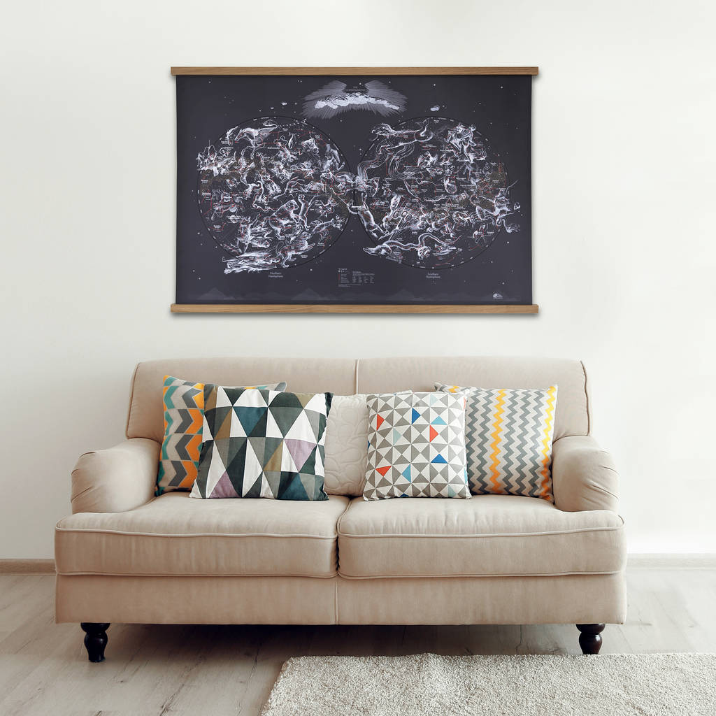
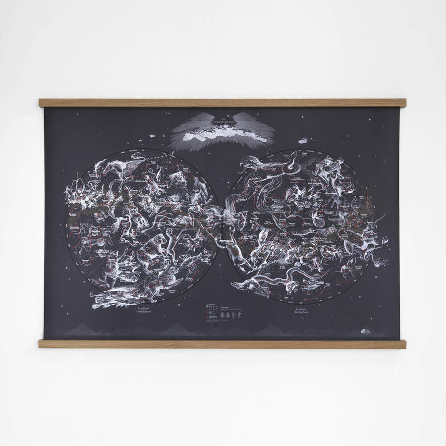
The night skies as seen from the northern and southern hemispheres, brought to life with original 17th century illustrations.
UK delivery only
Product description
The night skies as seen from the northern and southern hemispheres, brought to life with original 17th century illustrations.
Variations
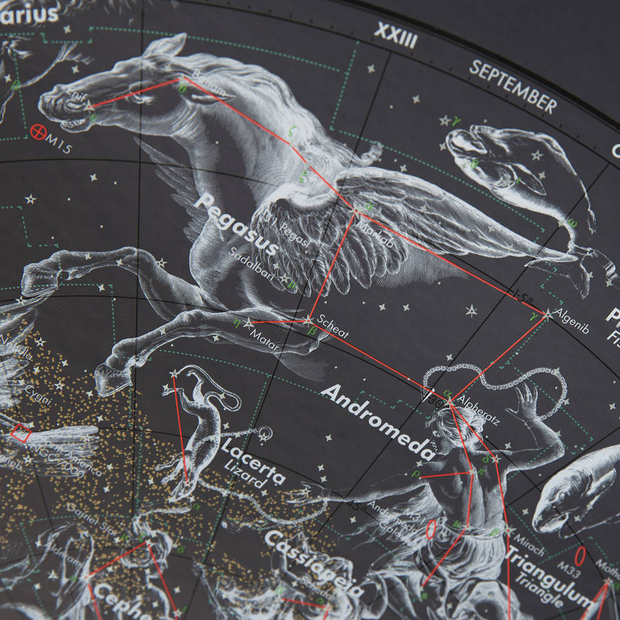
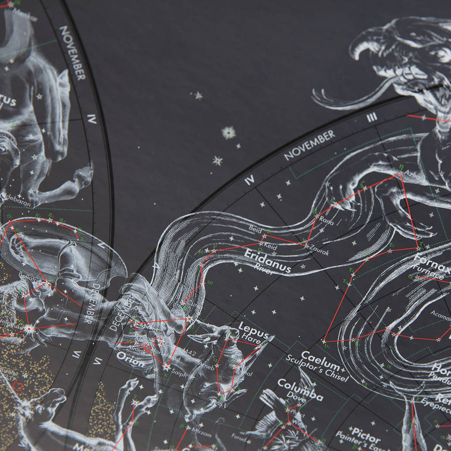
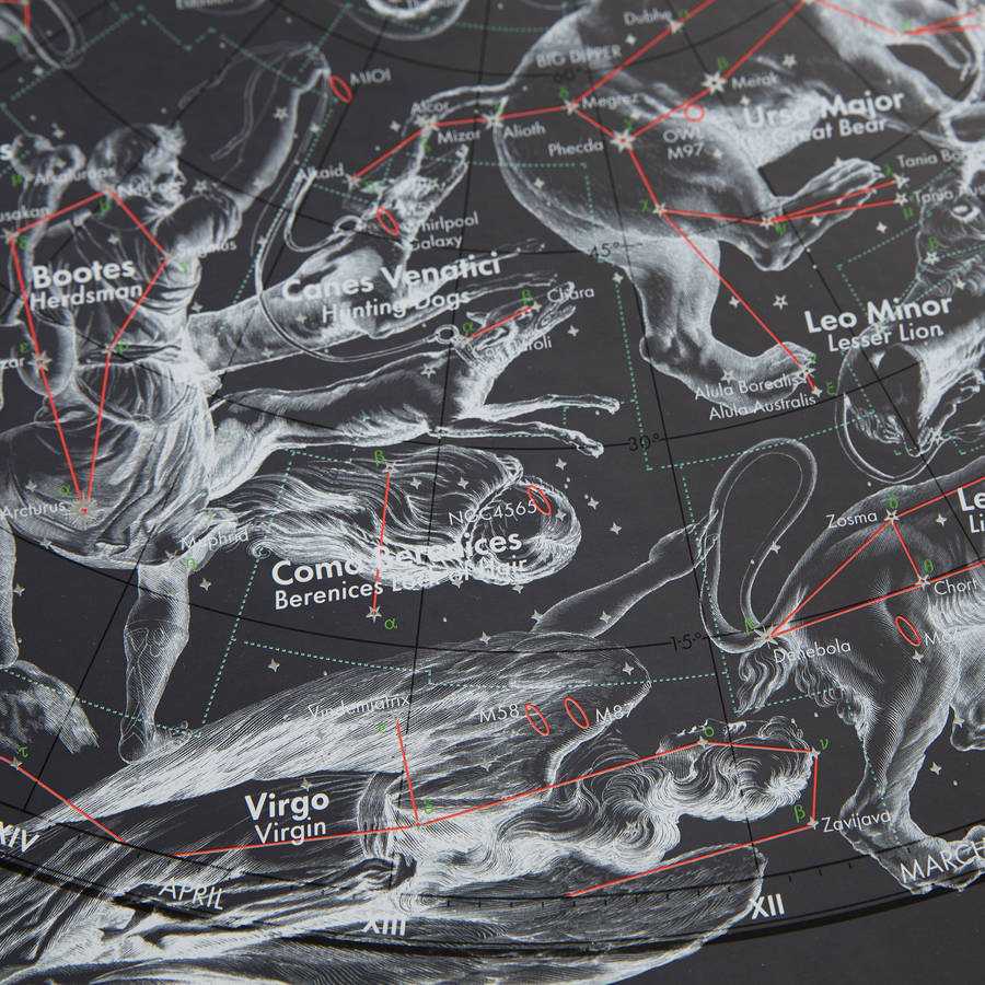
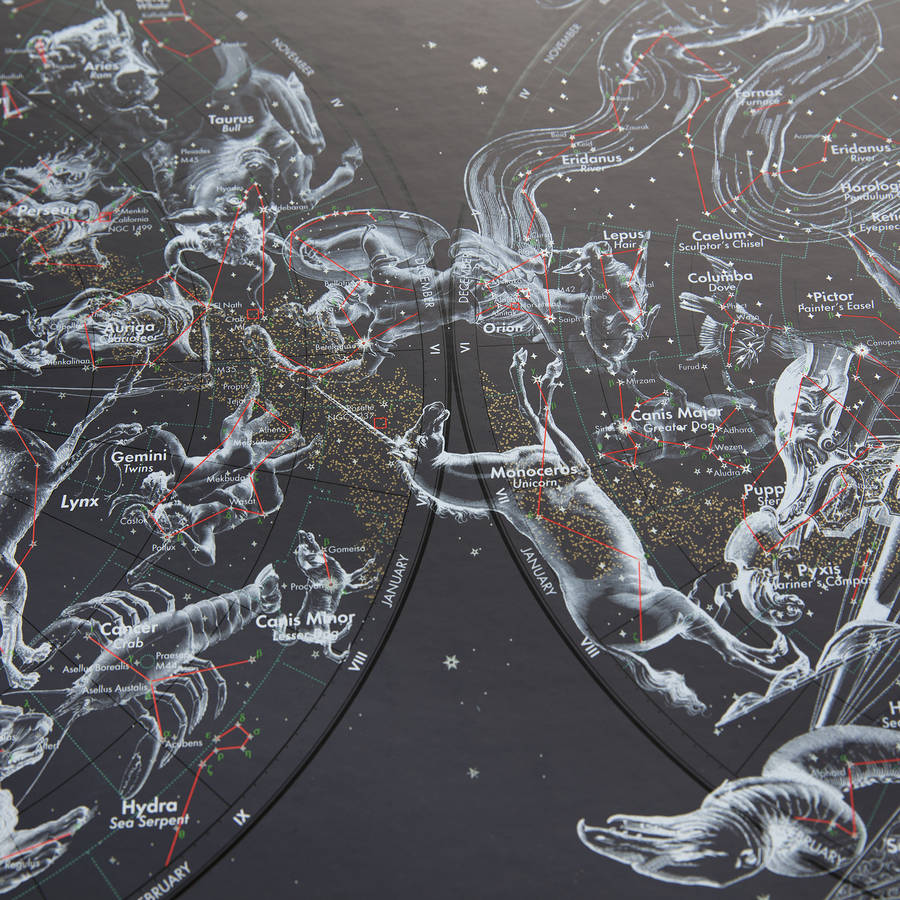
Our latest venture takes us to new heights as we explore The Heavens. This functional map shows every star directly observable by the naked eye indicated by magnitude and brightness. Also mapped are the nebulae, star clusters and galaxies visible from Earth. Original 17th century illustrations by Polish astronomer Johannes Hevelius depict the creatures and characters that inspired ancient astronomers to identify the constellations - we’ve included both Latin and English names. Their intricacy contrasts against eye-popping fluo, shimmering metallics and midnight blue, bringing the constellations to life. The result is a unique, educational map that makes a fantastic piece of wall art for dreamers and realists alike.
Overview
 Made in Britain
Dimensions
1000mm x 685mm
Made from
We print our maps on to the highest quality FSC approved silk-coated paper using a lithographic printing process. This works like a mechanised version of traditional screen-printing. A plate is made for each colour and then laid down individually, offering a stunning-quality print, with great definition and colour impact. A sealer is applied to protect the inks and gloss UV varnish used to add contrast and highlight boundaries.
Plastic Coated:We encapsulate the map in plastic to create a durable write-on/ wipe-off finish. Perfect for children or anyone with sticky fingers.
Magnetic:We mount our plastic coated map on to flexible sheet metal to create a durable, wipeable, magnetic surface. The map features magnetic strips on the back to enable you to fix it to the wall with ease. We supply stainless steel magnetic balls to mark points of interest and strong steel cylinders to convert the map in to a notice board.
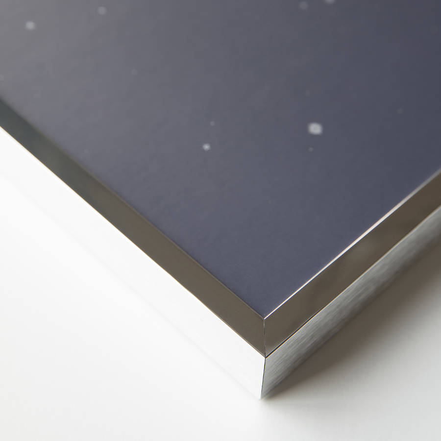
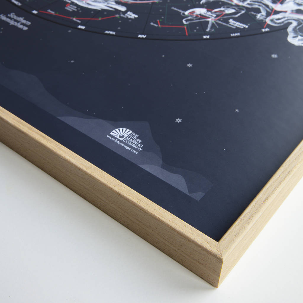
Framed:We frame our maps without glass to display the print quality in all its glory. The sealed finish allows your map to be cleaned gently with a damp cloth.
Framed Magnetic:This option combines the interactive nature of the magnetic map with the sharp presentation of our professional framing service.
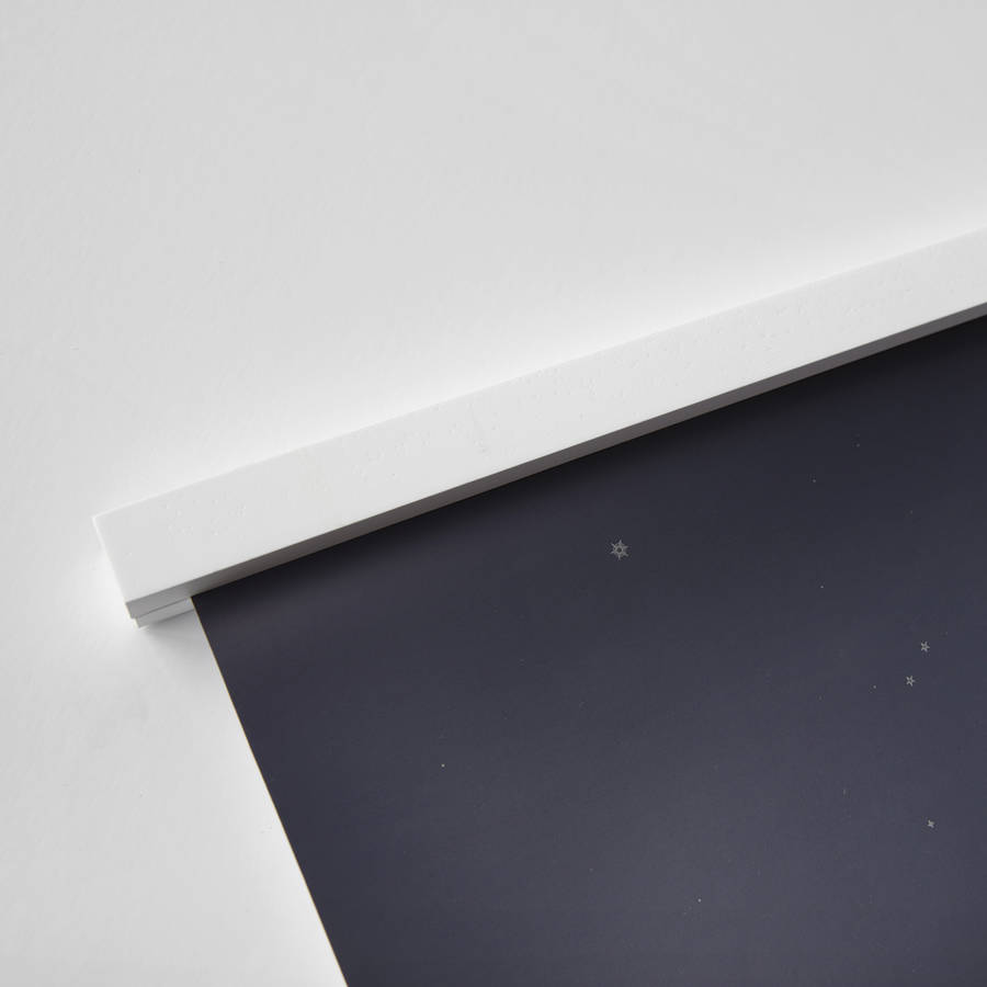
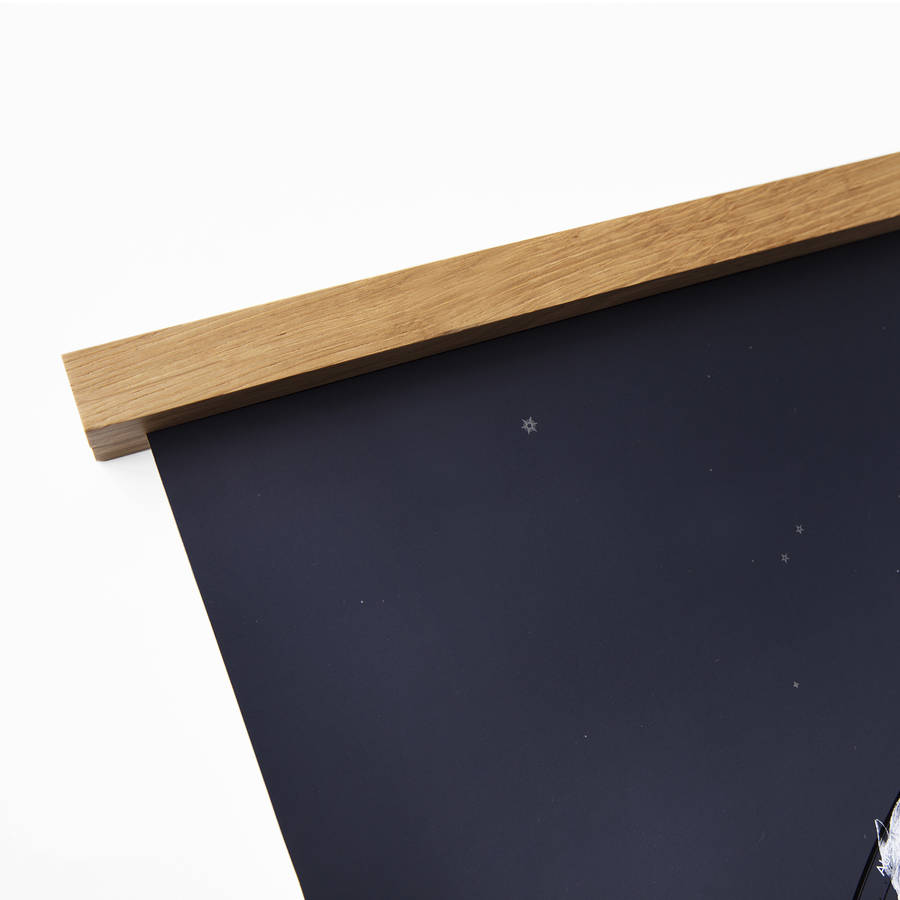
Hanging Rails: The rails come in two parts and work through the power of magnetism. The first piece is attached to your wall with rawl plus and screws (supplied). Your map is then sandwiched between this and the top rail by magnets in the rails. Sold in pairs so that you have a second rail to weigh the bottom of the map down.
Details: Country boundaries, capital and major cities, rivers, highest peaks, sea depths, North/South Pole projections and a shaded physical relief layer.
Warning: Our maps are approximately a million times more beautiful in real life than on your computer screen. The luminous colour and glossy metallics have been known to cause palpitations, so have a chair handy when it arrives.
Product code
656776
Customer reviews
Sorry, there are no reviews for this product yet.
UK delivery only
Returns
You have 28 days, from receipt of cancellable goods, to notify the seller if you wish to cancel your order or exchange an item.
Please note: goods that are personalised, bespoke or made-to-order to your specific requirements, perishable products and personal items sold with a hygiene seal (cosmetics, underwear) in instances where the seal is broken are non-refundable, unless faulty.